From movie scenes to Scientology symbols, Jon Revett reflects on thirty-five years of traveling on the Conchas Highway, in a landscape of shifting cultural narratives.
This article is part of our The Road series, a continuation of the ideas explored in Southwest Contemporary Vol. 13.
An invading army had crossed the southern border to take their homes and now their lives. The foreigners aim their rifles at the Americans, lined up alongside the road overlooking an expansive landscape, preparing to take their last breaths. Suddenly, automatic gunfire rings out as the faceless soldiers fall to an unseen ambuscade. On the ridge above the road, a group of teenagers emerges, including members of the local football team. One raises his assault rifle and yells a triumphant “Wolverines!”
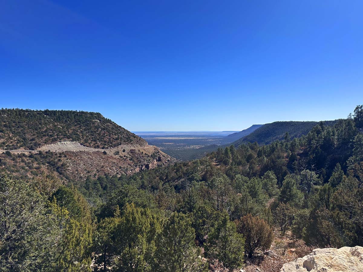
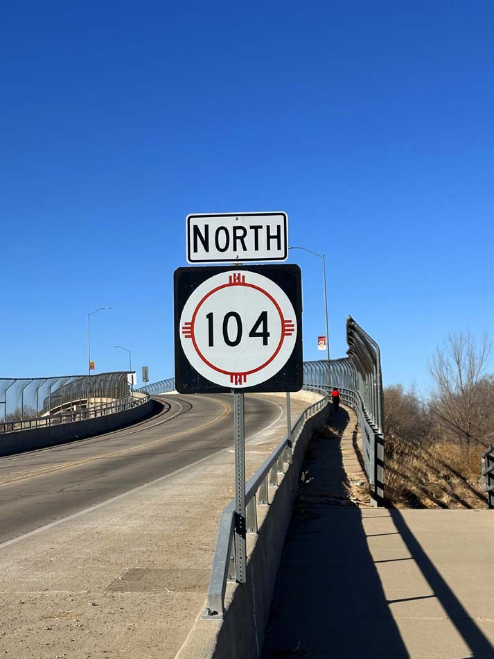
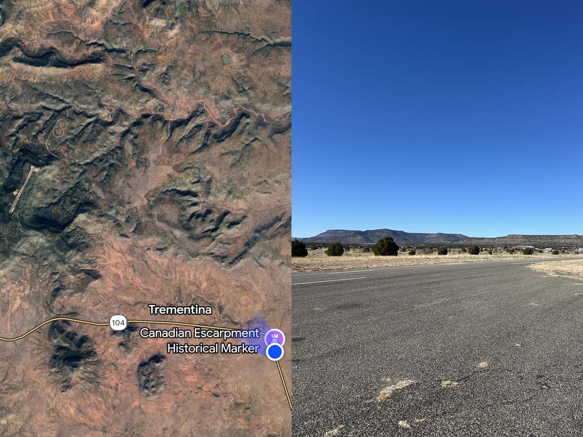
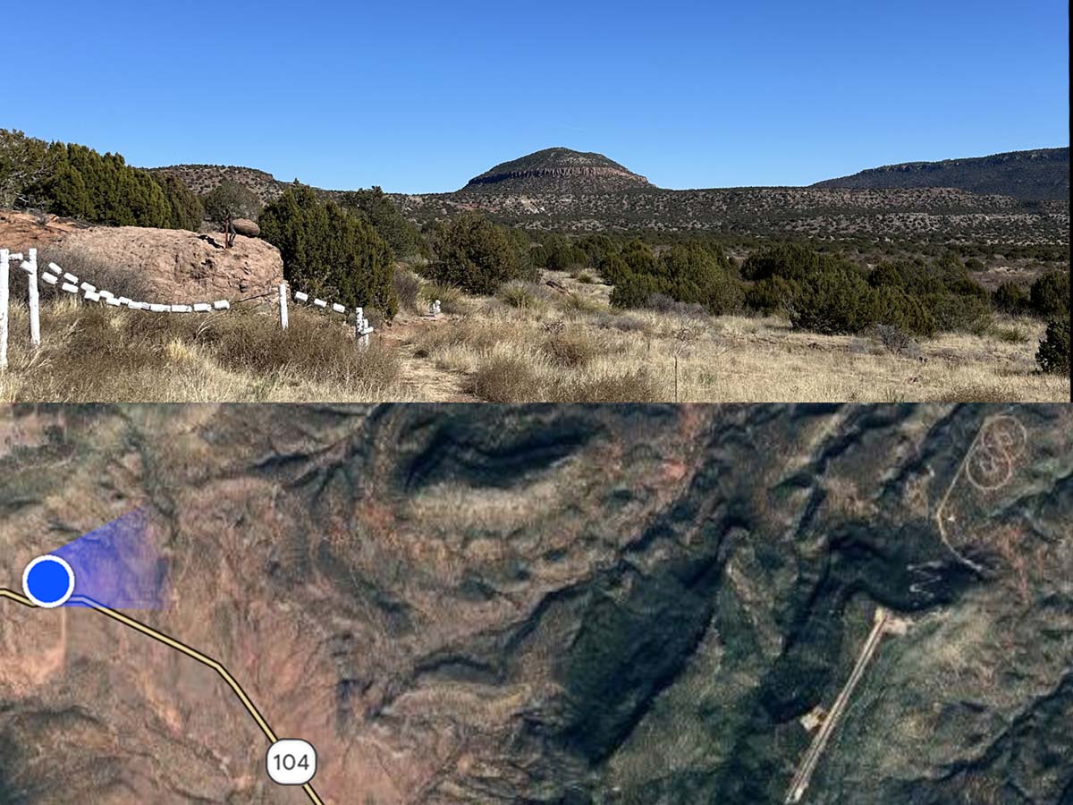
This scene, from John Milius’s 1984 film Red Dawn, was shot on a pullout on New Mexico State Road 104 on Corazon Hill, where the highway climbs 1,000 feet to the top of the Canadian Escarpment. The movie was made in and around Las Vegas, New Mexico, and when I was eighteen, I stopped at this very same pullout to watch the sunrise on my first solo road trip. I had no idea that the site of staged violence from Red Dawn—a film that replaced the absolutism of nuclear war with a Communist invasion, tapping into a new Cold War fear—had such a gorgeous view.
All I knew was this road was special, and ever since, it has been my escape route from my home in the Texas Panhandle to the mountains of Northern New Mexico. Travel has always been a way to gain new perspective for me. Thirty-five years of driving down this lonely strip of asphalt has curated a survey of monumental infrastructure, idealistic interventions, and religious sites that tell a story of how humans make sense out of the abstraction of wide open spaces.
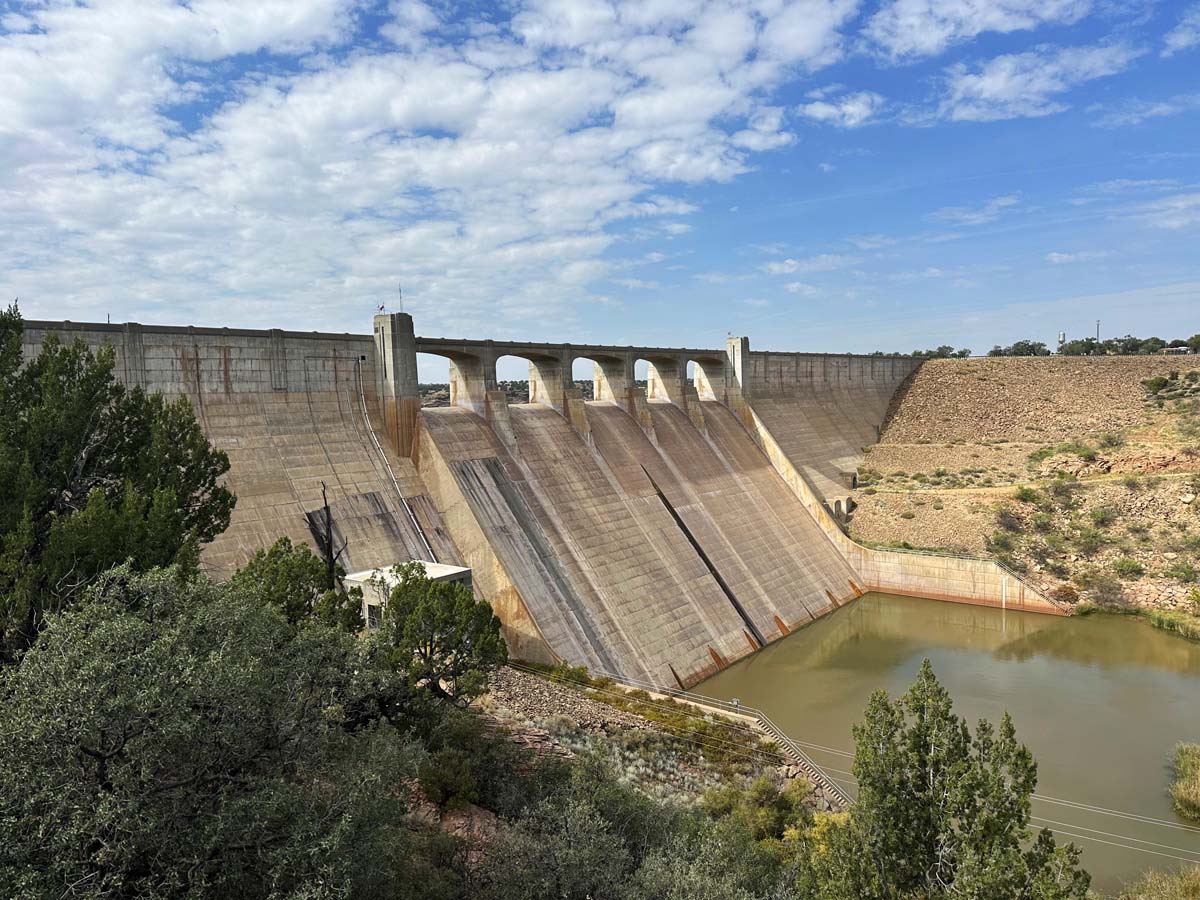
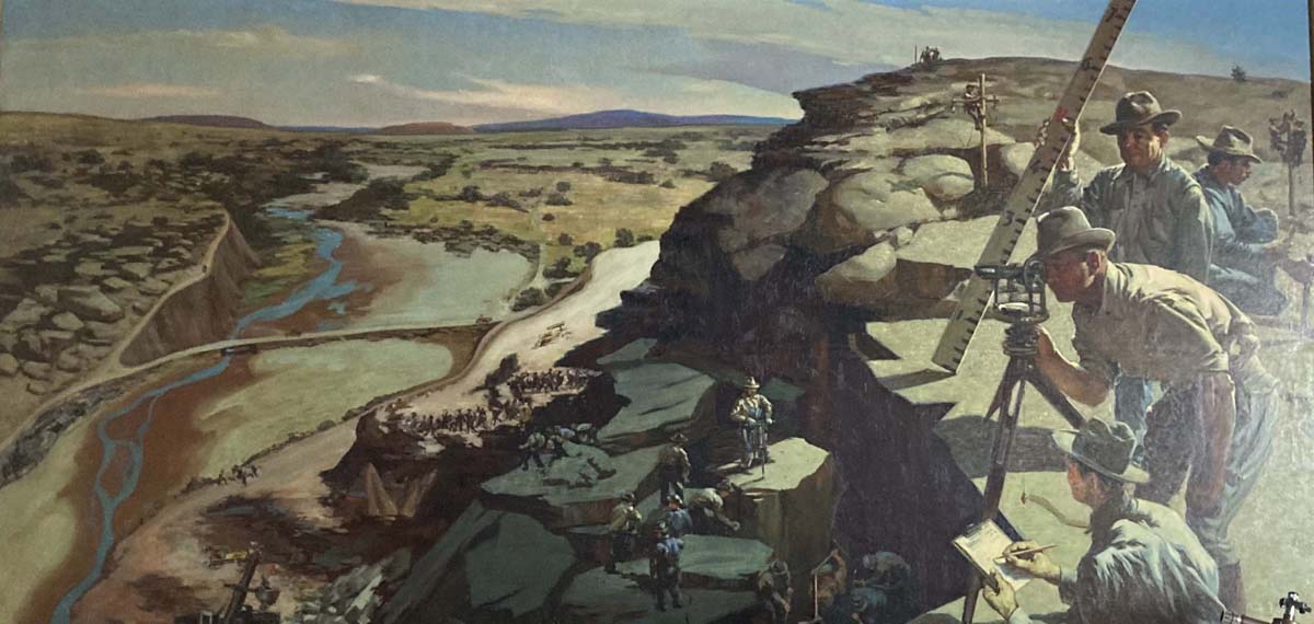
I call State Road 104 the Conchas Highway because it passes Lake Conchas, the first large manmade body of water on the Canadian River. It was created in 1939 when the U.S. Army Corps of Engineers built a 235-foot concrete gravity dam flanked by large earthen dikes during the Great Depression. Situated at the confluence of the Conchas and Canadian Rivers, the resulting reservoir can stretch twenty-five miles upstream. In the visitor center, two WPA-era Odon Hullenkremer murals memorialize the dam’s construction and the local settlement, before it went under the lake, in dynamic Regionalist glory.
The lake’s water is mountain fresh, and I would go the extra distance to Conchas instead of the muddy Ute or Meredith closer to Amarillo. The lake also provides the life blood of the region. At the southern end, an outlet feeds water into the Tucumcari Irrigation Project and its 300 miles of channels that irrigate over 41,000 acres of agricultural land southeast of the dam. These industrial-scale acequias began in 1940 as a “war emergency food plan,” transforming the semi-arid area surrounding Tucumcari into farmland. When full, the channels are smooth streams; when empty, manicured arroyos, both out of place among rocky red hills and scratchy green scrub.
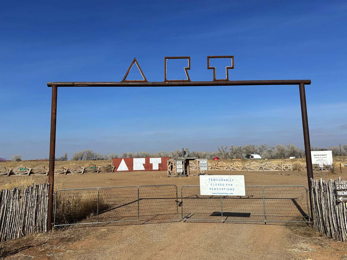
The irrigation project also turned Tucumcari, originally a railroad construction camp, into an agricultural hub. The intersection with its most famous thoroughfare, Route 66, is where the Conchas Highway starts. About ten miles north, a giant pair of lips floats in a sea of grass. Undulating beams of color wave at stacks of patterned wooden cubes and signal Art City, a sculpture park established by Matty Monahan, aka The Most Famous Artist, in late 2024, which he has described as “Storm King meets Meow Wolf meets Marfa.” Several sculptures are “Big Art” relics from Burning Man and Coachella, with more interactive installations hidden in a grove of trees at the back of the field.
The website proclaims, “Reviving Small Town America with Big Art and Community,” and Matty Mo’s plan is to use Route 66 tourism to bring change to culturally underserved communities. He cites Cadillac Ranch as inspiration, attributing its popularity to its location on the Mother Road, amplified by its interactive ritual of spray painting. However, decades of unchecked vandalism have taken their toll on the world-famous monument to the tailfin. When Ant Farm planted those ten Cadillacs in 1974, they were focused on getting their readymade roadside attraction in the ground and made no serious plan for preservation. Without one, the iconic artwork will not last a century.
West Texas and Eastern New Mexico have a harsh beauty. Sandblast wind, baking sun, and bipolar temperatures erode the concrete and steel. In its current form, Cadillac Ranch is an automotive sunset, sinking into the horizon. Both my attempts to visit Art City were prevented by a “closed for renovations” sign, which makes me worry it may also be on this abbreviated time scale, but I hope The Most Famous Artist’s city sticks around long enough to meet his revivalist goals. Neon-lit hotels along Route 66 still bring tourist dollars to Tucumcari, as do the surprising amount of weed shops that have cropped up. Maybe a psychedelic sculpture garden outside of town isn’t the worst idea.
Cultural contrasts play out through the history of the Conchas Highway.
At the other end of the Conchas Highway sits the “wildest town in the West” that attracted infamous characters like Billy the Kid, Jesse James, and Doc Holliday. Not to be confused with its younger Nevadian brother, the real Las Vegas is nestled on the southeastern edge of the Sangre de Cristos and prospered as the first resupply town on the Santa Fe Trail after the emptiness of the Great Plains. The city evolved into a turn-of-the-century destination for vacation and vice; luminaries like the Emperor of Japan visited the hot springs north of town and Teddy Roosevelt found many of his Rough Riders there. Montezuma Castle, a Carnegie Library, and a Harvey Hotel all give Las Vegas something that Art City has yet to cultivate: a history.
Time validates existence, and an unexpected religious site just off the Conchas Highway tries to prove that fact. Once, on a flight to the other Las Vegas, I saw two monumental diamond-centered interlocking circles engraved into the landscape. My Land Art roots inspired investigation. I discovered these shapes identify Trementina Base, northeast of the eponymous town on NM 104 not too far from where the Wolverines killed those commies on Corazon Hill. The geoglyph is the symbol of the Church of Spiritual Technology, or Scientology, and it marks the location of a subterranean storage facility that holds a complete collection of L. Ron Hubbard’s writings and recordings.
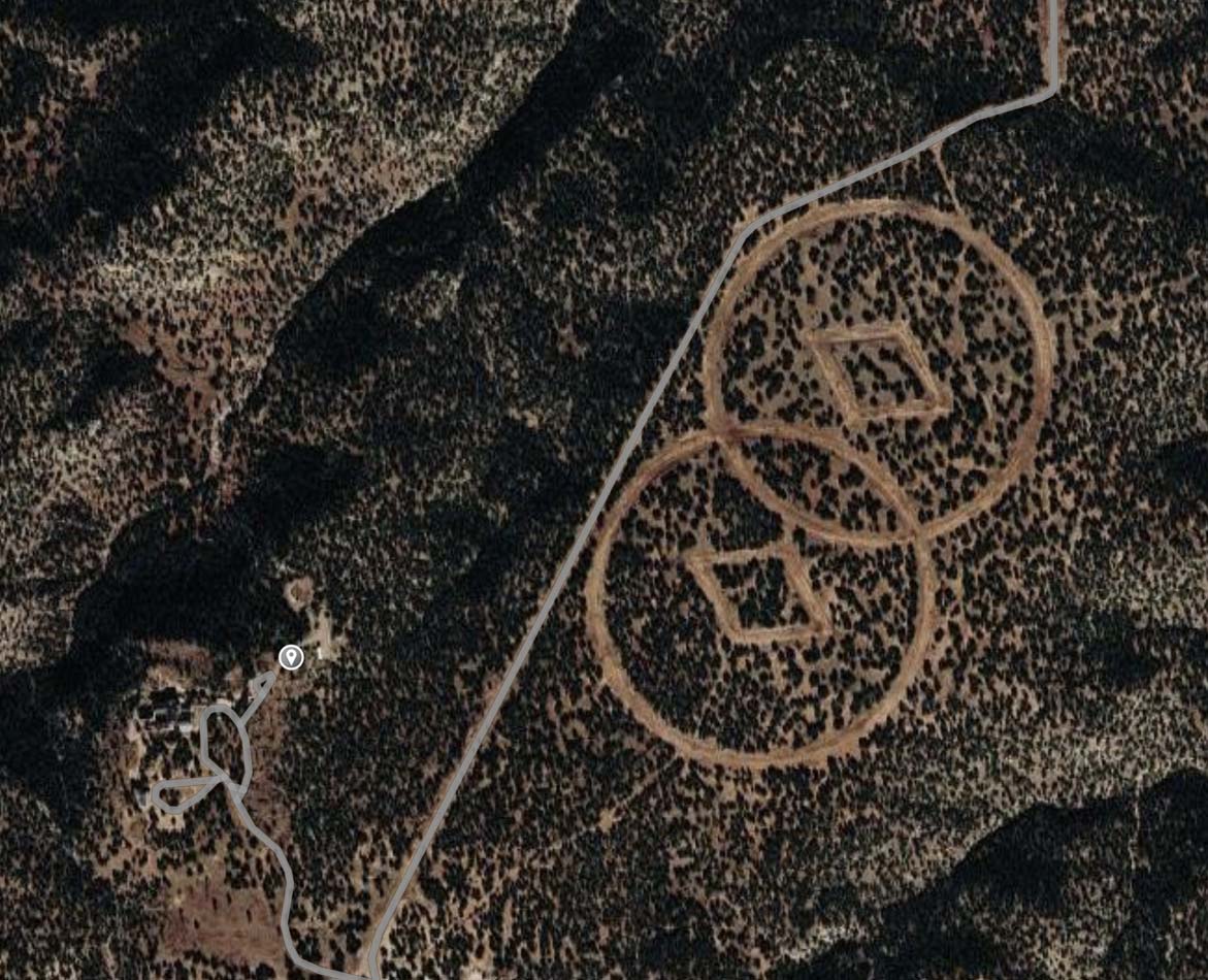
David Bloomberg, media relations for the Church, tells me the symbol is their corporate logo and represents “the universe and the continuum of time.” He sees these giant circles as art, but the Church believes “art is communication where public interpretation takes priority to that of the artist.” Bloomberg did not provide art historical facts like scale or date, but he did send me a link to a documentary about the challenge for “humanity’s youngest religion to take on humanity’s oldest adversary: time.”
In this archivist fever dream, Hubbard’s words have been reprinted, recorded, and etched onto stainless steel pages and nickel-plated records. These are sealed in argon-gas containers, which are placed in space-shuttle-grade ceramic time capsules then stored in an underground vault built to withstand all forms of catastrophe. Few modern religions are as concerned about the future as the Scientologists, and their earthwork is aligned with the intentions of the monument-builders of the past. The amount of time and money they spent on the seedbank of their religion demonstrates the same kind of dedication to faith that produced the Nazca Lines, the Serpent Mound, and Stonehenge.
Cultural contrasts play out through the history of the Conchas Highway. It connects the isolated long game of Trementina Base to the instant gratification of Art City. Long before it was paved, cowboys followed this path to the urban hedonism of Las Vegas while Comanches sat atop Tucumcari Mountain waiting to ambush them. Even that scene from Red Dawn gave ten-year-old me a surreal peace during the impending nuclear doom of the Cold War.
That movie capitalized on collective fear and had a major impact on me, almost as much as another film shot on NM State Road 104 (and not just because I worked security at its wrap party). In Cormac McCarthy’s No Country For Old Men, hitman Anton Chigurh walks into a store in Sheffield, Texas and toys with the terrified owner by assigning his psychopathic tendencies to a coin that has “traveled more than twenty-two years to get here.” When the Coen Brothers turned it into a movie, they filmed the coin toss scene at an old gas station on the Conchas Highway. In it, Chigurh discusses the importance of unnoticed things that accumulate over time and warns of an accounting. While he is the epitome of evil, he has a point.
Many travelers on the Conchas Highway may not pay attention to its strange menagerie, or see it as an aggregate of our attempts to control nature, change culture, and conquer time. My countless drives on the 107 miles of 104 stretched between Tucumcari and Las Vegas have shown me these monumental marks paint a bigger picture of the world in which we live, and homophones aside, this road has made me more conscious.