Trey Burns of Sweet Pass Sculpture Park explores the manufactured landscape of North Texas and its echo natures.
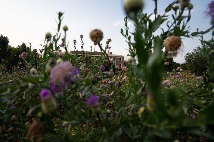
The campus of Southern Methodist University, or SMU, looks a bit like stock photography of the American college experience—generic brick and beige architecture is set like chess pieces among green, green grasses and full-growth trees. The prohibitively high tuition, abundant Greek life, overfunded athletic programs, and crumbling art school make it perhaps the perfect place for the George W. Bush Presidential Library.
Finished in 2013, the building’s exterior looks less like a presidential library than a modern high school. When I’m there I can’t help but hear an aughts-era Jon Stewart telling some easy jokes, like “What is it filled with, half-finished coloring books?” To be honest, I find it kind of spooky—the specter of the War on Terror looming behind a W. who’s been rebranded as the lovable grandpa who took up figure painting. And while I’ve never actually gone through the vaguely pantheonic entrance, the library has become an important nodal point in how I understand the North Texas landscape.
I relocated to Dallas in 2018 from New York when my wife took a visiting lecturer position at SMU teaching sculpture. The surrounding Metroplex, as the area is known, is a disorienting place to move to. It is a place of confused intention—a series of glitching façades over air-conditioned luster at one pole and poverty at the other. A place with an identity that is blurred and multiple, interwoven like its monumental highways. It is stacked perilously on top of itself, and spread so wide and thin that it becomes hard to grasp or hold on to—like a morning fog that’s quickly burned off in the sun.
Tucked behind the George W. Bush Library is the Native Texas Park. It’s what one Google reviewer calls “the definition of a hidden gem.” I have to agree, though with an acknowledgment of some palpable dissonance. Not only because of the kitchen smell from the library’s Cafe 43, but also the proximity to highways, high rises, and sports fields. As you meander through fifteen acres and a mile of tidy trails, you realize the whole garden is built into a bowl shape. This provides drainage to a cistern in the middle, but also acts to partially shield visitors from the unrelenting roar of the North Central Expressway just over the wall at the east side of the property.
The crunch of decomposed granite walkways leads you through an impeccably designed landscape that is tasteful, pristine, and bordering on uncanny. I genuinely love it there. It is a place I bring both out-of-town artist friends and relatives. While we walk and talk I always say the same things.
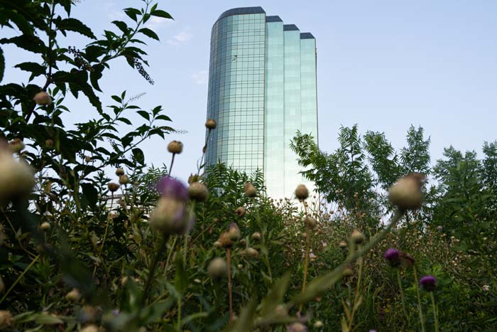
“Can you believe this cost $40 million to build? It’s almost a half a million a year to maintain.”
This is when I bend down and scratch at the soil to pull up some plastic filaments from the ground and show them to my companions.
“These are called Geofibers; they’re made of polypropylene. They help prevent the soil from eroding.”
In truth, I learned this fact from some landscape designer friends, and it always hits others as it did me. There is a sort of Hitchcockian-zoom-dolly-effect because once it is pointed out, you see it everywhere. This garden is plastic. The dual bands of the natural and the synthetic that have to this point found a quivering harmony are suddenly pushed irrevocably asunder.
A common analogy for a prairie is an upside down forest—a riot of fecundity whose network of entwined roots can reach fifteen feet deep. It goes without saying that an established prairie doesn’t require Geofibers® to prevent erosion because that function is part of the mutual contract.
Here at the Native Texas Park, a large portion of the selected plants were chosen to represent the highly endangered Texas Blackland Prairie—a vast and ancient ecosystem that once filled the floor of the endless horizon in North Texas. For thousands of years before the conurbation of the Dallas–Fort Worth Metroplex, Indigenous peoples such as the Caddo, Wichita, Tawakoni, and their ancestors cohabitated and thrived within this prairie. The arrival of settlers and colonists brought violence and genocide. The stolen prairie soil was plowed first for food, then cotton, trampled by cattle, and finally folded into an ever-expanding development. A fraction of a percent of this original prairie remains.
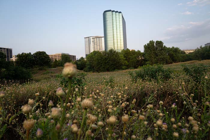
It’s not a matter that can be remedied by scattering seeds. The conditioning of the Texas Blackland Prairie soil and establishment of the indigenous species took thousands, or even millions, of years to develop. It’s simply impossible to sustainably recreate at scale. This reality, while depressing on the one hand, is also clarifying to a feeling I’ve always had in North Texas. The prairies’ absence is writ large on the resulting landscape. What Dallas has in abundance is that void—a city built on 360 degrees of emptiness.
In a previous life I had spent several years in Los Angeles where I got a sage piece of advice: LA is only truly interesting if you work to discover it, and you’re going to need a car to find it. I took it upon myself to apply that advice to my new life in Dallas.
So I began to drive around, aimlessly looping through the tangles of highways which entwine the electric spires of downtown and shoot off into all directions through continuous sameness. This new prairie of built environments is filled, not with a plan or pattern, but a looping rhythm. I began to ask myself, is the characteristic multi-species entanglement that defined the old prairie perhaps true of the new? For example, old prairie might be: grass, grass, forb, sedge, forb, legume, grass. Is new prairie: neighborhood, neighborhood, strip mall, office building, apartment building, interchange, and parking lot?
In my early days inside the megastructure I never quite knew when I was leaving one place and entering another. If I drove so far that I found an edge and the rhythms fell off, then I’d turn around and rejoin it, entering back into the loop.
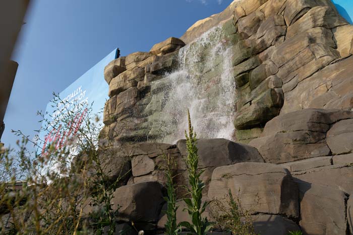
Every time I took the loop I noticed the Interstate 35 waterfall.
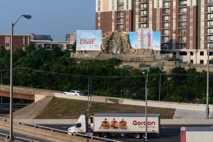
The waterfall billboard on Goat Hill was built in 1962 as an ad for the San Antonio–based Pearl Beer. The rushing water was meant to signal that the company’s deluxe lagers were made with pure and refreshing water from artesian springs. For more than sixty years it has been an ad space for beer and spirits and has also been the site of frat parties, vandalism, and detergent bombs. In a city with no striking natural features, the waterfall has become an iconic landmark. A friend I met early in Dallas tells a story about an inside joke with his father that developed in his youth. Every time they would drive past, he would say, “Look dad, a waterfall!” to which his father would respond, “What waterfall?”
In many ways this Möbius strip of water— continuously cycling, continuously reborn across the face of faux rocks—is a perfect analogue to the municipal water system of North Texas. The network of veins and arteries that spread through the ground of this new prairie to the homes and businesses of more than 7.5 million people is dizzying to think about. This massive mechanical and chemical Rube Goldberg machine is fed by forks of the Arkikosa/Trinity River and a constellation of man-made reservoirs.
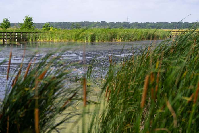
One of the odder points of this system lies thirty minutes south of Dallas near Seagoville. There, the 2,000-acre East Fork Wetland Project filters river water through a series of sedimentation basins and “wetland cells.” The biomimetic cells are cultivated with more than twenty different plant species which naturally remove pollutants from the water. An engineered slope gently guides the water through the wetland system over seven to ten days. At its terminus, the clean and clear water is then pumped forty miles north to reenter the game at Lake Lavon.
This sci-fi landscape, finished in 2009, was made possible by a public-private partnership between the North Texas Municipal Water District and the Rosewood Corporation, an international real estate company established in the 1930s by the wacky oil tycoon H.L. Hunt. A descendant of H.L. Hunt, John Bunker Sands first created the wetlands as a part of his personal Brahman cattle ranch. Today a small nature center nestled in the middle of the project is named in his honor.
The John Bunker Sands Wetland Center is a long and slender building of floor-to-ceiling windows encasing offices and classrooms. Colorful didactics, images, and infographics layer the walls of the interior, and a cross section of an industrial-scale water pipe sits in the front like a modernist sculpture. It is perfectly engineered as a base camp for a STEM field trip.
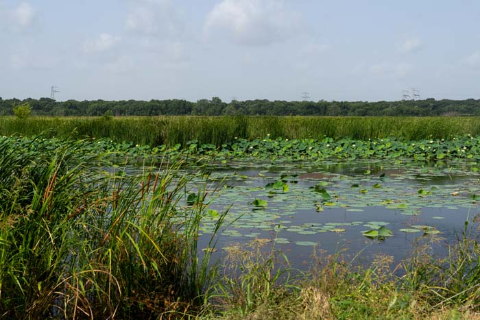
Below the building is a long and curiously narrow boardwalk that cuts sharply through the wetlands. Tall and reedy flora press up to the creaking path of gray, sun-cracked wood. The clomping of heavy heels triggers timid ibises to spring from their perch on the boardwalk railing and glide over shallow waters to continue fishing at a safer distance.
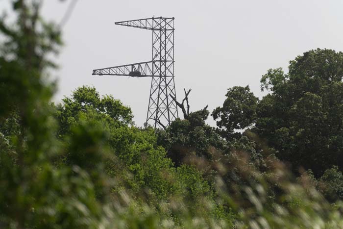
To the west, sitting in the tree line, is a solitary electrical pylon that resembles an uppercase F. Around 400 yards to the right, you’ll find its identical twin carrying high voltage lines along the edge of the wetland.
In 2012, two American bald eagles created a nest eighty feet above the ground on the arm of the active transmission tower. This tower, an otherwise perfect roost for an eagle, was a pathway for 325,000 volts of electricity. Fearing for the safety of the birds, the John Bunker Wetlands Center concocted a plan to relocate the arm and preserve the nest. In order to achieve this, they partnered with the local power company to create a replica tower a safe distance away. Then, while the birds were off on vacation they switched the arm to the dummy tower. The plan worked, and for years the migrating eagles went on nesting in this echo.
To mark their triumph with a cherry on top, the Wetland Center installed a webcam to observe the nest from above. For nearly ten years they tracked the subsequent generations of eagles while gaining a modest following on social media by posting eagle footage.
Then came an incident in 2021. The official story is that a local resident went to the tower at night and shined a bright light up at the eagles causing them to abandon their nest for four hours. The eagles returned, but were disturbed again when another idiot came back with a drone. After an egg hatched, the eaglet died shortly thereafter, causing the eagles to abandon the nest. According to the Wetland’s newsletter, “The harassment may well have affected egg development and led to [the eaglet’s] death.”
After the incident, the eagles built a new nest in a neighboring tree and were lost from the view of the camera. For months this webcam stared at the empty nest before being unceremoniously shut off, as it remains today.
To me, the empty nest in the vacant gaze of the webcam feels a little too on the nose—like falling through the map back to the void of the empty prairie. Looking at the vacant F in the landscape, it dawned on me that my journeys in the car, and those of the eagles, were both the result of searching and adapting to what we could find. I imagined the pair migrating past I-35, and one eagle saying to the other, “Look, a waterfall!”
