Rift / Fault
Radius Books, 2017
Fuck your short memory
Learn to swim
—Tool
There’s definitely definitely definitely no logic
To human behavior
—Björk
In art history classes, the slide pair is a powerful tool. Project two images side by side, and they are like two flint rocks, one setting a spark off the other. Compare and contrast: it’s always easier to understand something when you can say what it is not.
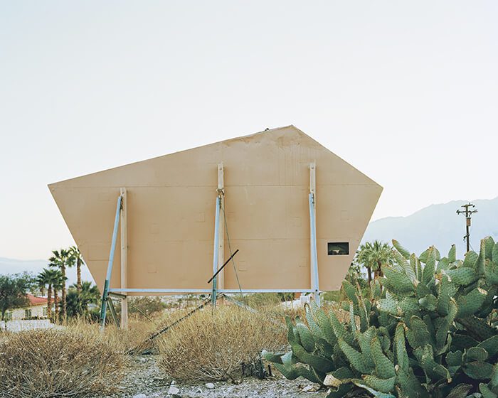
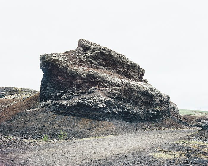
Rift / Fault, Marion Belanger’s new book of photographs published by Radius Books, presents two sets of images, each top-bound so the reader/viewer can choose her own adventure—reveal each numbered pair simultaneously or veer from the catalogue and make her own pairings. The left set of photos picture landscapes along the San Andreas Fault, which runs down the coast of California, alternating between land and the Pacific Ocean. On the right are images that Belanger took as she followed the Mid-Atlantic Ridge, as it runs under and through Iceland. The two image groups—their color washed out to invite parallels in each region’s imagery, as Lucy Lippard observes in her deft introduction to the book—invite a seemingly infinite number of morphological and cultural comparisons.
The 2008 financial crisis hit Iceland harder than anywhere else in the world. In Belanger’s photos of Iceland and California, homes abandoned mid-construction attest to the suddenness of the breakdown of the world economy. Faux-stone facing creeps halfway up the stucco façade of a cookie-cutter Spanish revival in San Bernardino; raw concrete surfaces remain unfinished on a tract of homes built during the Nordic housing bubble. These are ruins, but in reverse. Over and over, images of the suburbs in both regions attest to the absurdity of humans insistent on building their homes on unstable land. In 1973, a volcano erupted for nearly six months straight and split open the island of Heimaey, enlarging its area by a third. Belanger’s photos of the volcano’s excavation site, which reveal the tops of houses peeking out from under a massive rundown of volcanic rock and ash, also show the environs surrounding the site: a new crop of oblivious suburban homes. In other photos, the stark differences between the United States’ yen for capitalistic exploitation and Iceland’s commitment to sustainability become difficult to ignore. Corroded signs advertising homes near California’s now-uninhabitable Salton Sea contrast with pipes traversing Iceland’s verdant hillsides, carrying geothermal steam to heat greenhouses and turf-covered geodesic domes. If that were the US, I thought reflexively, those would be oil pipelines.
Corroded signs advertising homes near California’s now-uninhabitable Salton Sea contrast with pipes traversing Iceland’s verdant hillsides, carrying geothermal steam to heat greenhouses and turf-covered geodesic domes.

Since its invention, photography has served as a tool for surveying the landscape. Representation, we have learned, has been for modern Western culture a means of exerting control by imposing a narrative onto a subject—landscapes, native cultures, and genders have all felt the yoke of such representation. George M. Wheeler’s nineteenth-century project to photograph the United States west of the 100th meridian imposed a narrative of expansion and control over a geographical area defined by a man-made border, the line of longitude. Belanger notably abandons any pretense toward mastery by replacing institutional boundaries with geologic ones. Tectonic plates, constantly shifting beneath our artificial constructions—of home, of safety, of daily life—are ultimately the only ones that matter. Belanger leaves how we interpret that reality up to us.


