The City of Santa Fe’s ArcGIS Storymaps, and its AR component, Ojos Diferentes, peel back the layers of Santa Fe history to tell underrepresented stories with new technologies.
This article is part of our Radical Futures series, a continuation of the ideas explored in Southwest Contemporary Vol. 10
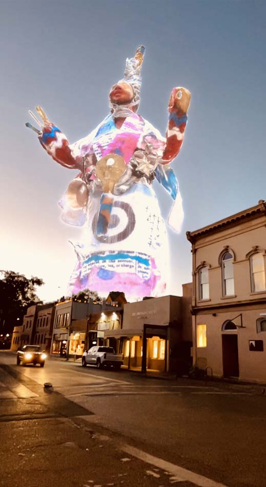
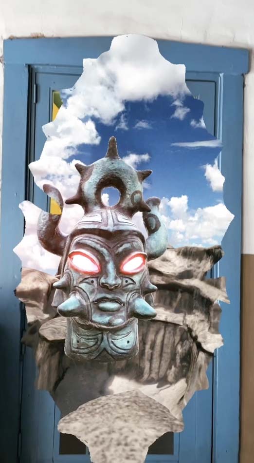
SANTA FE, NM—Down a dimly lit corridor, encapsulated in thick adobe walls that hug the courtyard of an old Spanish colonial building, lies a portal. In it, the bust of a mysterious character—both ancient and futuristic—floats against a timeless, blue skyscape dotted with puffy white clouds and jutting rock formations, inviting those who notice it into a realm that speaks beyond the immediate space. The hovering figure, an augmented reality art piece by Virgil Ortiz (Cochiti Pueblo), casts a shadow on the one-time residence built on a Spanish land grant, revealing that the surrounding plaza area was a pivotal location for one of the most consequential events in New Mexico history, the Pueblo Revolt of 1680. For Pueblos, the Revolt assured the vibrancy of future generations by successfully expelling the Spanish from New Mexico for twelve years. In the years that followed the Revolt, Pueblos reoccupied and reclaimed the space (a Pueblo settlement long before the Spanish arrived) both physically and architecturally; they built a contiguous, Pueblo-style complex in the city center.
Uncovering hidden histories—like this one—using new technologies is the impetus behind Santa Fe’s ArcGIS StoryMaps, a project set into motion by Valerie Rangel. When she applied for Santa Fe city historian (an honorary position that she held from 2021 to 2023), she proposed the idea of revealing Santa Fe’s historical layers through ArcGIS StoryMaps, which, according to the project’s website, is “a type of digital story-telling [sic] platform that combines images, text, and video to enhance learning and illustrate spatial relationships with visual appeal.” According to Rangel, she wanted to highlight stories from various perspectives with the goal of giving people “as many different ways to gather knowledge, to have a diverse understanding in preparation for making policy changes or plans for the future.”
In 2022, the project expanded to include an artistic component entitled Ojos Diferentes, inviting artists from multiple backgrounds working in a variety of mediums to create eight site-specific pieces utilizing AR technology in collaboration with Rangel, the Santa Fe Arts and Culture Department, and Refract Studio. The goal was to further contextualize selected landmarks, and to encourage dialogue on how these historical events continue to shape the present.
On this expansion, Rangel states, “All the artists brought something that I never thought about, that I have no way of bringing—their perspective, and another way of seeing things. It surprised me and I felt like [they] added something different, every single one of them.” Each AR experience can be viewed through a Snapchat filter by waving a smart phone over the location of the historical landmark. For those who are looking to take a deeper dive, further resources—including maps, archival photographs, videos, essays written by Rangel, artist AR videos and statements, as well as lesson plans and educational tools for K-12 instructors—are accessible on the City of Santa Fe’s ArcGIS StoryMaps website.
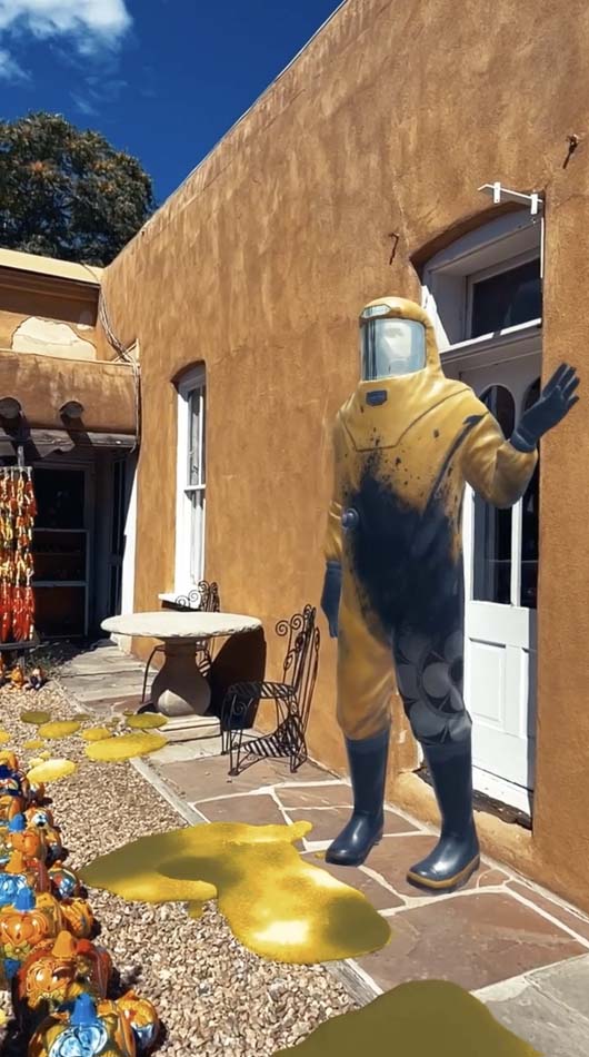
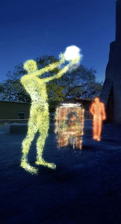
According to Rangel, Storymaps lends itself to creating a self-guided tour. Sites are located throughout Santa Fe and beyond, but those situated in the plaza area are easily within walking distance from each other. Near the office where Robert J. Oppenheimer and his team of scientists launched the Manhattan Project, viewers can see a lab worker wearing a hazmat suit as Olivia Romo recites her poem “Jornada del Muerto.” And, only few blocks away, in front of San Miguel Chapel, they can watch Aztec dancers, PAZ (Mapitzmitl) and his daughter, Crystal Xochitl Zamora, perform an invocation to the four directions.
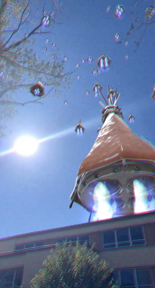
One Ojos Diferentes contributor, Santa Fe-raised multimedia artist Ehren Kee Natay (Diné/Kewa Pueblo), discovered that the area along the Santa Fe River corridor, where his landmark is located, used to have an orchard that fed students from Ramona Industrial School, a government-run boarding school that accommodated primarily Apache children whose parents were being held as prisoners by the U.S. Army at Fort Union. Throughout his immersive AR experience, a virtual assistant–sounding narrator guides viewers through different historical scenes that have been recreated using archival photographs, including one of a Pueblo woman gathering water from the river in an olla and another of Ramona Industrial School children.
Natay concludes the time-travel vignette with a scene in which Indigenous people have harnessed the technology to construct their own aircraft, which, in his imagining, they do so out of traditional dwellings. As he explains, “These are our homes, these are the places that we dwell, that we build, that have a rootedness in the ground.” By situating them, in his words, “rising,” in a future setting, he hopes to prompt viewers, particularly Indigenous viewers, to ask themselves, “What are the possibilities, what is the future that you can imagine where Indigenous people have these technologies and capabilities to go beyond—to go beyond into the atmosphere, into space?” He continues, “They [Indigenous viewers] might just have an inspiration, an idea that they never saw before, of what’s possible. You don’t know what’s possible until you can actually see it, and that’s what I really like about doing AR and working in new media technologies. You can start to visualize these things that you’ve never seen before and once you see it, it becomes real.”
To find more information on ArcGIS Storymaps and Ojos Diferentes, visit their website here.
